
Account
Pictures


Tandem Club GPX/TCX Rides list
 |
Id: 1707, Quality: 5 Group: PublishedRoute Location: BA3 5LS Postcode: BA3 5LS Map Reference: 51.0064, -2.19841 Ride length: 12 km Ride ease: Easy Added by: Neil Wheadon | |
 |
Id: 1698, Quality: 5 Group: PublishedRoute Location: Gillingham Postcode: SP8 4AT Map Reference: 51.0381, -2.27802 Ride length: 24 km Ride ease: Average Added by: Neil Wheadon | This is the first part of the seemingly forgotten North Dorset Cycleway. Signs are still at most junctions, but there is nothing on the web, aside a pretty poor map on the Dorset County Council website. You start at Gillingham where there is a station, but for ease, I have used the closest car park ... |
 |
Id: 1258, Quality: 5 Group: PublishedRoute Location: Market Harborough Postcode: LE16 7DT Map Reference: 52.4788, -0.91012 Ride length: 27 km Ride ease: Easy Added by: Neil Wheadon | See https://www.sustrans.org.uk/find-a-route-on-the-national-cycle-network/brampton-valley-way/ Start at Market Harborough Station, St Mary's Rd, Market Harborough LE16 7DT SURFACE:- The Brampton Valley Way spans over 14 miles between Northampton and Market Harborough, what was once a disused railwa ... |
 |
Id: 1122, Quality: 5 Group: PublishedRoute Location: Haverfordwest Postcode: SA61 1TP Map Reference: 51.8016, -4.96537 Ride length: 42 km Ride ease: Hard Added by: Neil Wheadon | See https://www.pembrokeshire.gov.uk/cycle-pembrokeshire/cycle-pembrokeshire-wizo-trail Trave/map icon at https://tandem-club.org.uk/rides?cmd=placeView&id=10303 This was manually written up using RidewithGPS (with care) as no GPX was available. The Trail meanders through part of the central area of ... |
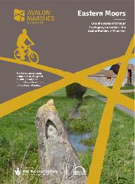 |
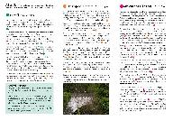
Id: 715, Quality: 5 Group: PublishedRoute Location: Glastonbury Postcode: BA8 8LZ Map Reference: 51.1406, -2.7074 Ride length: 23 km Ride ease: Easy Added by: Neil Wheadon | see Avalon Eastern Moors Ride https://avalonmarshes.org/explore/things-to-do/cycling/ This route explores the eastern marshes including Queen's Sedge Moor, Hearty Moor, Kennard Moor and the green fringes of the Isle of Avalon. |
 |
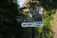
Id: 616, Quality: 5 Group: PublishedRoute Location: Sturminster Newton Postcode: DT10 1BN Map Reference: 50.9269, -2.30266 Ride length: 20 km Ride ease: Easy Added by: Neil Wheadon | This is the correct way that the North Dorset trailway runs (unlike the most popular Google search that is wrong on both ends, the path does not extend north of Sturminster Newton) Details at northdorsettrailway.org.uk The North Dorset Trailway now extends approximately 14 miles from Sturminster New ... |
 |
Id: 2026, Quality: 4 Group: PublishedRoute Location: Carmarthan Postcode: SA32 7EP Map Reference: 51.8685, -4.24033 Ride length: 19 km Ride ease: Easy Added by: Neil Wheadon | See https://www.discovercarmarthenshire.com/explore/tywi-valley-path/ https://www.discovercarmarthenshire.com/explore/tywi-valley-path/ The Tywi Valley Path can be explored from Carmarthen or Llandeilo, giving you the freedom to plan your journey exactly how you like. You can join the path at differ ... |
 |
Id: 2005, Quality: 4 Group: PublishedRoute Location: Grassington Postcode: BD23 5LB Map Reference: 54.0697, -1.99675 Ride length: 46 km Ride ease: Average Added by: Neil Wheadon | Start at Grassington National Park Visitor Centre, Hebden Rd, Grassington, Skipton BD23 5LB See https://cyclethedales.org.uk/route/upper_wharfedale/ This is the route via Kettlewell and I've plotted it as close as I can to the map provided. The GPX from the sire referred to doesn't take you to Kettl ... |
 |
Id: 2003, Quality: 4 Group: PublishedRoute Location: Duns Postcode: TD11 3DF Map Reference: 55.7778, -2.34341 Ride length: 8 km Ride ease: Easy Added by: Neil Wheadon | The starting point for the routes is the car park at the south end of Murray Street, a cul-de-sac off the south side of the Market Square. (11-13 Murray St, Duns TD11 3DF) See https://scotlandstartshere.com/tours/nisbet-rhodes/ A very short loop south of Duns. |
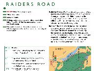 |
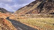
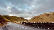
Id: 2000, Quality: 4 Group: PublishedRoute Location: New Galloway Postcode: DG7 3RN Map Reference: 55.0745, -4.14085 Ride length: 34 km Added by: Neil Wheadon | Start at High St, New Galloway, Castle Douglas DG7 3RN See https://www.dumfriesandgalloway.gov.uk/leisure-sport-culture/parks-outdoor-spaces/core-paths See https://scotlandstartshere.com/tours/new-galloway-to-loch-clatteringshaws-loop/ You can go either direction from New Galloway for a beautiful ro ... |
 |
Id: 1999, Quality: 4 Group: PublishedRoute Location: Innerleithen Postcode: EH44 6HA Map Reference: 55.6199, -3.06176 Ride length: 61 km Ride ease: Hard Added by: Neil Wheadon | Start from the east end of the High Street, Innerleithen EH44 6HA See https://scotlandstartshere.com/tours/moorfoots-gala-water/ Heading north from Innerleithen, this route climbs over the Moorfoot Hills to a height of 350m above sea level before descending to the village of Heriot. The route return ... |
 |
Id: 1998, Quality: 4 Group: PublishedRoute Location: Moffat Postcode: DG10 9JT Map Reference: 55.3362, -3.43381 Ride length: 71 km Ride ease: Hard Added by: Neil Wheadon | Start at Moffat Independent Hostel , Well Rd, Moffat DG10 9JT See https://scotlandstartshere.com/tours/moffat-triskelion-north-loop/ See https://moffattriskelion.com/ Embark on 75km full of iconic southern Scottish climbs and views! The North Loop of the Moffat Triskelion will see you tackling the n ... |
 |
Id: 1997, Quality: 4 Group: PublishedRoute Location: Moffat Postcode: DG10 9JT Map Reference: 55.3362, -3.43381 Ride length: 82 km Ride ease: Hard Added by: Neil Wheadon | Start at Moffat Independent Hostel , Well Rd, Moffat DG10 9JT See https://scotlandstartshere.com/tours/moffat-triskelion-south-east-loop/ See https://moffattriskelion.com/south-east-loop/ The Moffat Triskelion is 250km of stunning road cycling broken into three loops that start and finish in Moffat, ... |
 |
Id: 1996, Quality: 4 Group: PublishedRoute Location: Moffat Postcode: DG10 9JT Map Reference: 55.3362, -3.43381 Ride length: 108 km Ride ease: Hard Added by: Neil Wheadon | Start at Moffat Independent Hostel , Well Rd, Moffat DG10 9JT See https://scotlandstartshere.com/tours/moffat-triskelion-north-loop/ See https://moffattriskelion.com/ See https://moffattriskelion.com/west-loop/ The GPX has been downloaded from Strava as supplied there. The most demanding loop! Two s ... |
 |
Id: 1993, Quality: 4 Group: PublishedRoute Location: Melrose Postcode: TD6 9SW Map Reference: 55.5986, -2.74049 Ride length: 24 km Ride ease: Average Added by: Neil Wheadon | Start at Melrose TD6 9SW See https://scotlandstartshere.com/tours/midlem-lindean/ This route heads east from Selkirk and climbs to the summit on Lindean Moor and then undulates passing Lindean Loch Nature Reserve. The route then turns towards Midlem and on to Lilliesleaf. The route climbs away from ... |
 |
Id: 1991, Quality: 4 Group: PublishedRoute Location: Innerleithen Postcode: EH44 6QX Map Reference: 55.6182, -3.06578 Ride length: 89 km Ride ease: Hard Added by: Neil Wheadon | Start at 1 Peebles Rd, Innerleithen EH44 6QX See https://scotlandstartshere.com/tours/megget-talla/ This route heads south from Innerleithen passing Traquair House and along the Paddy Slacks towards the Gordon Arms. Turning right into the Yarrow Valley and then on towards Tweedsmuir. With a steep cl ... |
 |
Id: 1990, Quality: 4 Group: PublishedRoute Location: Peebles Postcode: EH45 9EN Map Reference: 55.6494, -3.1916 Ride length: 29 km Ride ease: Average Added by: Neil Wheadon | The starting point for route is Kingsmeadows car park, located on the south side of the River Tweed, just over the bridge from the west end of the High Street. (1-2 Kingsmeadows Rd, Peebles EH45 9EN) See https://scotlandstartshere.com/tours/manor-valley/ Leave Peebles and head into open countryside ... |
 |
Id: 1989, Quality: 4 Group: PublishedRoute Location: Duns Postcode: TD11 3DF Map Reference: 55.7777, -2.3436 Ride length: 26 km Ride ease: Average Added by: Neil Wheadon | The starting point for the route is the car park at the south end of Murray Street, a cul-de-sac off the south side of the Market Square. (11-13 Murray St, Duns TD11 3DF) See https://scotlandstartshere.com/tours/longformacus/ This route heads north from Duns and passing Duns Law. The route climbs an ... |
 |
Id: 1984, Quality: 4 Group: PublishedRoute Location: TD5 7BL Postcode: Kelso Map Reference: 55.5961, -2.4274 Ride length: 37 km Ride ease: Average Added by: Neil Wheadon | Start at the carp park by the river Kelso TD5 7BL See https://scotlandstartshere.com/tours/harestanes/ A route taking you south and west of Kelso passing Bowmont Forest before turning west where you can stop at Teviot Water Garden & Smokery. After this you cross Kalemouth suspension bridge and the r ... |
 |
Id: 1983, Quality: 4 Group: PublishedRoute Location: Eyemouth Postcode: TD14 5SD Map Reference: 55.8719, -2.08661 Ride length: 43 km Ride ease: Hard Added by: Neil Wheadon | The route starting point is from the car park at Gunsgreen House, located on the east side of the harbour and accessed from the A1107 via The Avenue. See https://scotlandstartshere.com/tours/grantshouse/ This route travels south from Eyemouth towards Ayton Castle. The route then continues eastwards ... |